
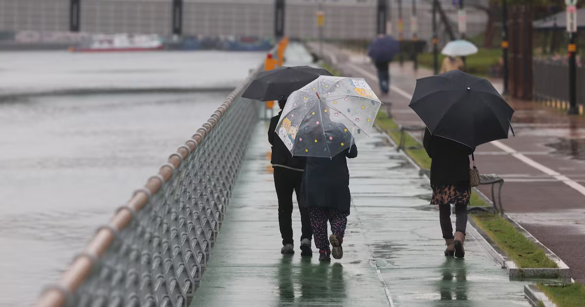

Korea Meteorological Administration Issues Late October 2024 Forecast: Nationwide Rain and Temperature Drop Expected for November 1
On October 30, 2024, the Korea Meteorological Administration (KMA) released a detailed weather outlook covering the transition from October into early November, highlighting a significant shift in conditions across the Korean Peninsula. The forecast called for lingering rain in central regions through the early hours of October 31, followed by a nationwide expansion of precipitation on November 1, accompanied by a noticeable drop in temperatures and a suite of secondary hazards including dense fog, strong winds, and elevated coastal waves.
Overview of the Forecast Period: October 31 – November 1, 2024
The period marked a classic late-autumn pattern: a trough passing north of the peninsula pulled moisture inland, while radiative cooling overnight set the stage for widespread fog. The KMA emphasized that while total rainfall amounts would remain modest for most areas, the timing and coverage of the November 1 event would affect the entire country, making it the more impactful of the two systems.
This forecast was issued on October 30, 2024, and reflects the KMA’s operational guidance at that time. Actual observed conditions may have varied; readers seeking verified historical data should consult the KMA’s official climate records.
Detailed Rainfall Forecast: From Central Regions to Nationwide Coverage
According to the KMA’s October 30 briefing, a pressure trough moving across the north would bring light rain to the greater Seoul metropolitan area (excluding northwestern Gyeonggi), inland and mountainous Gangwon, northern South Chungcheong, and central and northern North Chungcheong through the pre-dawn hours of October 31. Accumulations were expected to be minimal, generally under 5 mm.
The more substantial system arrived on November 1. Rain was forecast to begin in the southwestern Gyeonggi region during the morning, spread to the Chungcheong provinces by late morning, and expand to the southern regions and Jeju Island by afternoon. By evening, precipitation would cover the entire country, tapering off from the central region and Honam after midnight, and from Yeongnam and Jeju by the morning of November 2.
| Region | Expected Rainfall (Nov 1) |
|---|---|
| Gwangju, Jeonnam, Jeju | 5–30 mm |
| Seoul, Incheon, Gangwon | Under 5 mm |
| Chungcheong, Jeonbuk, Busan, Ulsan, Gyeongnam, Daegu, Gyeongbuk | 5–10 mm |
| Seohae 5 Islands | 5–10 mm |
The KMA flagged a specific risk for Jeju Island late on November 1, where thunderstorms could produce rainfall rates of 20 mm per hour, accompanied by lightning, gusty winds, and possible hail — a localized but intense hazard.
Temperature Trends: A Seasonal Drop Into Early November
Temperatures were forecast to reflect the deepening autumn chill. On October 31, morning lows ranged from 4°C to 13°C, with daytime highs reaching 14°C to 21°C. By November 1, the cold air advection behind the rain system pulled readings down further: lows of 3°C to 10°C and highs of only 11°C to 18°C — several degrees below the seasonal average.
- Seoul/Incheon: 8°C / 14°C (Oct 31)
- Daejeon: 10°C / 17°C
- Gwangju: 10°C / 19°C
- Daegu: 7°C / 19°C
- Ulsan: 8°C / 20°C
- Busan: 11°C / 21°C
The diurnal range remained wide, typical of clear, dry autumn nights transitioning into cloudier, rain-cooled days.
Fog and Visibility Hazards: Widespread Dense Fog Overnight
A significant non-precipitation hazard highlighted in the forecast was radiation fog forming during the overnight hours of October 30–31. The KMA warned of visibility dropping below 200 meters in inland areas of South Chungcheong, central and northern North Chungcheong, inland Jeonbuk, Jeonnam, central and northern inland Gyeongbuk — essentially the central and southern interior basins.
Elsewhere, visibility was expected to fall below 1 kilometer. The agency specifically noted that river valleys, lake shores, and mountain basins would experience the densest fog, urging caution for drivers and noting potential impacts on aircraft operations. Travelers were advised to check flight status in advance.
Wind and Fire Risk: Gangwon Mountains and East Coast on Alert
While much of the country dealt with moisture, the Gangwon mountain and coastal areas faced a contrasting threat: strong, dry downslope winds. From the night of October 30 into October 31, the KMA forecast gusts reaching 55 km/h (approximately 15 m/s) along the coast and up to 70 km/h (19 m/s) in the mountains.
Combined with falling relative humidity, this created elevated wildfire risk — a recurring concern in the Yeongdong region during autumn. The public was urged to avoid open flames and report any smoke sightings immediately.
Coastal Conditions: Swell Waves Expected on the East Coast
Beginning the afternoon of October 31, a long-period swell was forecast to propagate into the East Sea (Sea of Japan), generating high waves capable of overtopping breakwaters and rocky shores. The KMA advised the public to avoid coastal trails, breakwaters, and rock fishing spots through at least November 1, as sudden wave run-up poses a serious drowning hazard even in fair weather.
Historical Context and Forecast Verification
The October 30 – November 1, 2024 period represents a typical late-autumn transition in Korea: a weakening continental high yields to a passing mid-latitude cyclone, bringing a brief wet spell before a reinforcing cold surge. The KMA’s forecast correctly captured the phasing of precipitation (central-first, then nationwide), the modest quantitative rainfall outside Jeju, and the multi-hazard nature of the event (fog, wind, waves, fire weather).
For researchers and forecasters, this case serves as a textbook example of compound weather hazards in the shoulder season — where no single element is extreme, but their overlap increases societal impact. Post-event verification using KMA AWS (Automatic Weather Station) data and radar archives would confirm the accuracy of fog onset timing, wind gust maxima, and the Jeju convective burst.
Key Takeaways for Public Preparedness
- Carry rain gear on November 1 regardless of region — the system was nationwide.
- Allow extra travel time on the morning of October 31 due to dense fog, especially in valley and basin areas.
- Monitor aviation notices if flying domestically on October 31.
- Avoid open flames in Gangwon mountain/coastal zones through October 31.
- Stay off exposed East Coast shorelines from the afternoon of October 31 onward.
The October 30, 2024 KMA forecast demonstrates the value of integrated, impact-based messaging — addressing not just “will it rain?” but “what else happens at the same time?” — a practice increasingly central to modern operational meteorology in Korea and worldwide.
News, Weather, Korea, Meteorology, Forecasting, Public Safety, Transportation, Aviation, Wildfire Risk, Coastal Hazards, Fog, Autumn Weather, Korea Meteorological Administration, Historical Weather, Seasonal Transition, Compound Hazards, Impact-Based Forecasting, Seoul, Gyeonggi, Gangwon, Chungcheong, Jeolla, Gyeongsang, Jeju, East Sea, Travel Advisory