

Winter Storm Warning: Heavy Snow Expected in Alaska with Low Visibility Concerns
Alaska residents and travelers should prepare for a significant winter storm hitting the state’s interior regions starting Thursday evening, bringing up to 15 inches of snow and hazardous driving conditions. The National Weather Service (NWS) has issued a winter storm warning for the Northern Susitna Valley, including critical corridors like the Parks Highway and Denali Highway. Forecasters warn of rapidly accumulating snow and visibility dropping to as low as a quarter mile, creating dangerous scenarios for motorists navigating two-lane highways. This storm arrives at a particularly inopportune time for those traveling between Anchorage and Fairbanks or planning a journey along the Denali Highway, which closes to regular traffic on October 1st annually.
Snow Totals and Timing: When to Expect the Worst
The NWS Anchorage office has outlined a detailed timeline for this storm system. The winter storm warning is active from 5 p.m. ET Thursday to 6 p.m. ET Friday. Initial light snowfall is expected to precede the warning, accumulating an additional 3 to 6 inches in some areas. The heaviest phase of the storm hits Thursday night and Friday morning, with rapid snow accumulation rates pushing totals toward the upper end of the 7 to 15-inch range. As temperatures rise above freezing on Friday afternoon, the precipitation type is expected to shift from snow to rain, potentially creating wet slush over existing snow accumulations—a deceptive hazard for drivers expecting the roads to improve.
The Parks Highway, a vital connection between Alaska’s two largest cities, will face particularly challenging conditions. NWS Anchorage specifically highlights concerns about rapidly changing visibility along this corridor, where snow can accumulate quickly and reduce sight distances to less than a quarter mile. Similarly, the Denali Highway—which serves as the only paved route to Denali National Park—will experience severe winter conditions during its short seasonal operational window.
Driving Hazards in Quarter-Mile Visibility
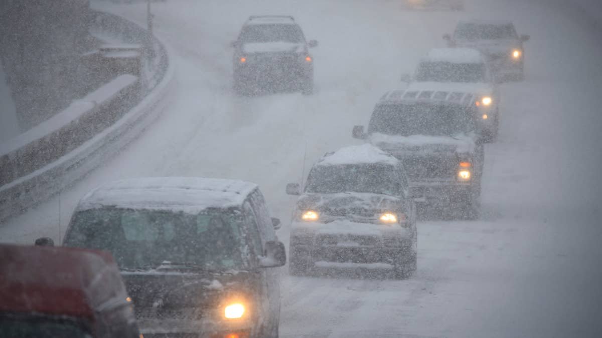
A quarter-mile visibility zone in heavy snow equates to roughly 1,320 feet—distance that can shrink to near-zero within seconds as snow bands pass through. Alaska’s Department of Transportation and Public Facilities (DOT&PF) emphasizes a critical safety measure: keeping headlights on, not just taillights. Many modern vehicles with daytime running lights automatically disable rear lights, leaving drivers less visible to oncoming traffic. In narrow, two-lane highways like those affected by this storm, this visibility difference can be the distinction between a safe passage and a collision.
Snow removal operations amplify the danger, often creating sudden whiteout conditions as plows push snow across the roadway. DOT&PF advises maintaining a minimum of 200 feet of separation from snowplows and never attempting to pass these vehicles on the right—where they cannot see or expect other traffic. This precaution helps avoid the dangerous scenario of a snowplow encountering unexpected traffic in its path of travel.
Rain-Snow Mix and Ice Formations by Friday Evening
As temperatures cross the freezing threshold on Friday afternoon, the precipitation type will shift from snow to rain. This transition creates a particularly treacherous surface condition: liquid water flowing over ice, forming slush banks that can change rapidly. DOT&PF emphasizes that ice forms first on bridges and overpasses—even when surrounding pavement appears frozen or wet. These elevated surfaces offer no thermal mass to retain warmth, making them the first and most unpredictable hazard during this type of weather event.
The NWS Anchorage office reminds motorists to check 511.alaska.gov or dial 511 for real-time road condition updates. They also recommend keeping an emergency kit in vehicles—including a flashlight, non-perishable food, and water—since weather conditions can strand travelers unexpectedly. This preparation becomes especially critical along the Denali Highway, where distances between services span hundreds of miles.
Extended Weather Impact and Travel Recommendations
Beyond the immediate storm impacts, travelers should be aware that conditions may persist in localized areas through the weekend. Freezing precipitation can create black ice—invisible glazed surfaces—that form under specific temperature and moisture conditions. DOT&PF advises delaying non-essential travel during peak storm hours and maintaining extra caution during any movement. For those planning Denali Highway trips, note that summer access ends October 1st, but unexpected winter weather can create hazardous conditions well before official seasonal closures.
For real-time updates, follow @NWSAnchorage on social media or monitor local radio stations. Alaska’s vast geography means weather conditions can vary dramatically over short distances—conditions clear one mile may differ significantly from those just around the next bend.
Categories: News, Weather, Transportation, Alaska, Winter Storm, Parks Highway, Denali Highway, National Weather Service, Alaska DOT&PF, Road Conditions, Snowfall Forecasts