

Flash Flood Warning Issued: Heavy Rainfall Threatens Seminole County and Orlando Areas
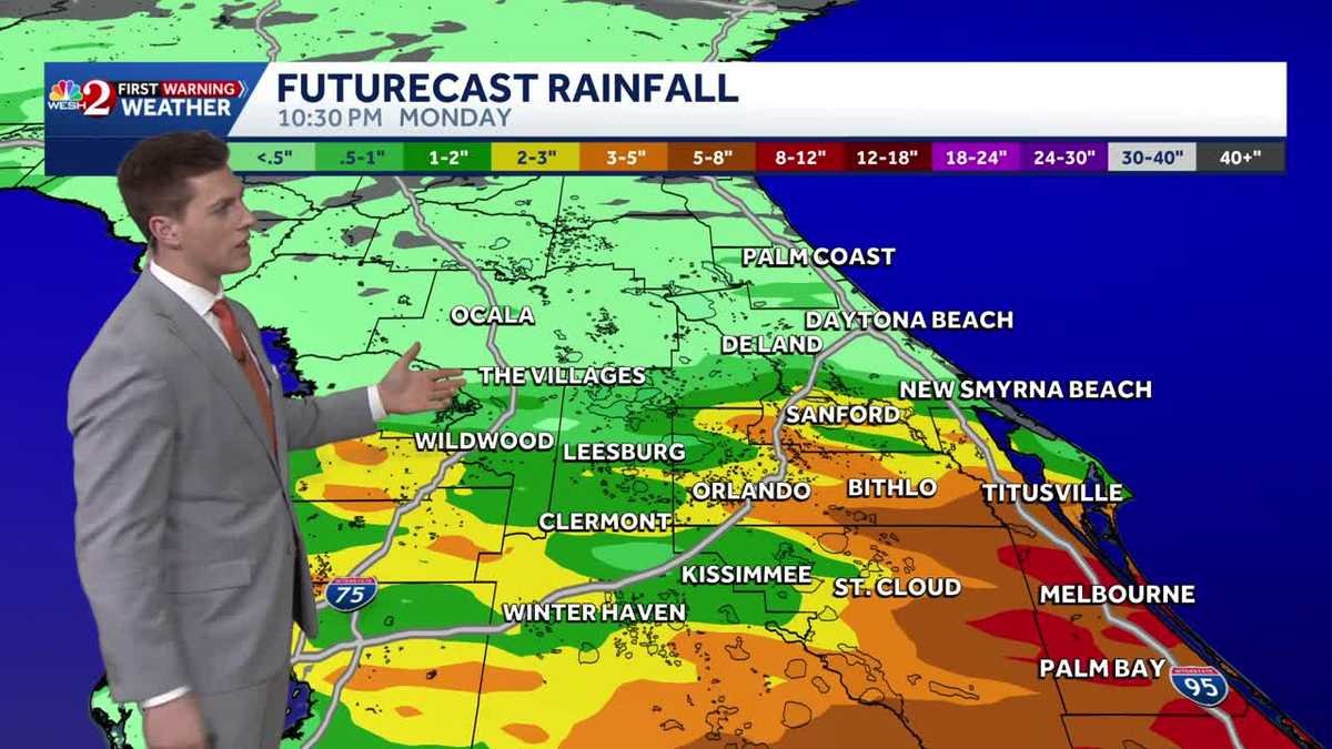
Residents in Central Florida are being urged to exercise extreme caution as severe weather patterns move through the region. A flash flood warning has been officially issued for Seminole County, lasting until 10:30 pm, signaling an immediate threat to low-lying areas and roadways. With heavy rainfall expected to persist through Sunday and Monday, local authorities and meteorologists are monitoring rapidly developing storm cells that could lead to significant property damage and hazardous driving conditions.
Meteorological Outlook for Sunday and Monday
The weather pattern currently impacting the Orlando metropolitan area is characterized by rounds of heavy, concentrated precipitation. According to meteorologist Luke Vickery, the threat is not limited to a single burst of rain but rather a series of heavy downpours that can saturate the ground and overwhelm local drainage systems.
As the storm system progresses, the primary concern for residents is the cumulative effect of the rainfall. When ground saturation reaches its limit, even moderate additional rain can trigger sudden flash flooding. The forecast indicates that the moisture-rich air will continue to fuel these storm rounds through Monday, potentially complicating commutes and outdoor activities across Central Florida.
High-Risk Areas and Flooding Potential
While the entire region may experience rain, certain zones are at a higher risk for inundation. Understanding where the most intense rainfall is expected can help residents prepare. The following table outlines the general areas of concern based on current meteorological modeling:
| Region/County | Primary Threat | Timeline |
|---|---|---|
| Seminole County | Flash Flooding | Immediate (until 10:30 PM) |
| Orlando Metro | Localized Flooding / Heavy Rain | Sunday through Monday |
| Low-lying Urban Areas | Street & Drainage Overload | Ongoing |
Key Safety Precautions for Residents
To mitigate the risks associated with these heavy rain rounds, experts recommend the following safety measures:
- Monitor Local News: Stay tuned to local weather updates and National Weather Service (NWS) alerts for real-time changes.
- Avoid Travel: If possible, stay off the roads during the heaviest periods of rainfall, especially in Seminole County.
- Check Drainage: Homeowners should ensure that gutters and nearby storm drains are clear of debris to prevent water from pooling near foundations.
- Emergency Kits: Ensure you have access to flashlights, batteries, and necessary medications in case of localized power outages caused by wind or flooding.
Understanding Flash Flood Mechanics
A flash flood is defined by its speed. Unlike river flooding, which can take days to develop, flash floods occur within minutes or hours of heavy rainfall. In urban environments like Orlando, “impervious surfaces”—such as asphalt roads, parking lots, and concrete sidewalks—prevent water from soaking into the ground. This forces the water to run off instantly into streets and drainage systems, which can quickly become overwhelmed.
“The most dangerous aspect of these upcoming rain rounds is the unpredictability of where the heaviest cells will track. A single intense cell can cause significant flooding in a very small, specific neighborhood while leaving adjacent areas relatively dry.” — Weather Analysis Summary
Conclusion: Staying Prepared Through Monday
As the heavy rain rounds continue into Monday, the situation in Seminole County and the Greater Orlando area remains fluid. While the immediate flash flood warning provides a critical window for action tonight, the ongoing threat throughout the next 24 to 48 hours requires sustained vigilance. By staying informed and respecting the power of moving water, residents can navigate this weather event with minimal risk to life and property.
News, Communities, Government, Science, Transportation, Orlando, Seminole County, Florida, Flash Flood Warning, Weather Forecast, Heavy Rainfall, Luke Vickery, Meteorologist, Public Safety